Scroll down to see temperature list and interactive map.
Hottest Temps Last Week:
51C | 123F at Basra, BA, Iraq
47C | 117F at Baghdad, BG, Iraq
45C | 113F at Phoenix, AZ, United States
44C | 112F at Riyadh, 01, Saudi Arabia
44C | 111F at Chandler, AZ, United States
44C | 110F at Maricopa, AZ, United States
43C | 110F at Irving, TX, United States
44C | 110F at Death Valley, CA, United States
43C | 109F at Garland, TX, United States
43C | 109F at Hurst, TX, United States
42C | 108F at Valley View, TX, United States
42C | 108F at Dallas Arts District, TX, United States
42C | 107F at Sweetwater, TX, United States
42C | 107F at Dallas, TX, United States
41C | 106F at Dubai, DU, United Arab Emirates
41C | 106F at Yuma, AZ, United States
41C | 105F at Lawton, OK, United States
41C | 105F at Abilene, TX, United States
40C | 104F at Roswell, NM, United States
40C | 103F at San Felipe, BCN, Mexico
39C | 103F at Midland, TX, United States
39C | 103F at Mesa, AZ, United States
40C | 103F at Terlingua, TX, United States
39C | 103F at Fort Worth, TX, United States
39C | 102F at Dakar, DK, Senegal
39C | 102F at Del Rio, TX, United States
38C | 100F at Monterrey, NLE, Mexico
35C | 95F at Taipei City, TPE, Taiwan
COLDEST Temps Last Week:
-72C | -98F at Amundsen-Scott South, 00, Antarctica
-63C | -82F at Concordia Station, 00, Antarctica
The temperature range between the Earth’s poles is drastic due to a combination of factors, including the tilt of the Earth’s axis, the distribution of sunlight, and the circulation of ocean currents and air masses.
One of the main reasons for the temperature difference is that the Earth’s axis is tilted at an angle of approximately 23.5 degrees relative to the plane of its orbit around the Sun. This means that the poles receive sunlight at a very oblique angle, resulting in less intense solar radiation and cooler temperatures.
Additionally, the distribution of sunlight is uneven due to the Earth’s rotation and the presence of the atmosphere, which causes some areas to receive more or less sunlight than others. The poles receive very little direct sunlight during the winter months, which leads to prolonged periods of darkness and extreme cold.
Finally, the circulation of ocean currents and air masses plays a significant role in the temperature differences between the poles. The ocean currents near the poles are cold and dense, which causes them to sink and flow towards the equator, while warm currents from the equator flow towards the poles. Similarly, cold air masses from the poles move towards the equator, while warm air masses from the equator move towards the poles.
All of these factors combine to create a drastic temperature range between the Earth’s poles, with the Arctic and Antarctic experiencing some of the coldest temperatures on the planet.
The weather surrounding our planet is in constant change. We are recording the extreme world temperatures hourly. This page presents the locations ( for which we receive data ) that made it into the hottest and coldest locations. The temperatures displayed are for one or more hours per the indicated location during the last 7 days. Hottest at the top of the list, Coldest at the bottom.
Scroll down to see temperature list and interactive map.
Hottest Temps Last Week:
50C | 122F at Basra, BA, Iraq
49C | 120F at Death Valley, CA, United States
48C | 118F at Yuma, AZ, United States
46C | 115F at Mexicali, BCN, Mexico
45C | 113F at Abu Dhabi, AZ, United Arab Emirates
45C | 113F at Chandler, AZ, United States
45C | 112F at Riyadh, 01, Saudi Arabia
41C | 106F at Baghdad, BG, Iraq
41C | 105F at Abilene, TX, United States
41C | 105F at Wichita Falls, TX, United States
41C | 105F at Sweetwater, TX, United States
39C | 103F at Phoenix, AZ, United States
39C | 102F at Pierre, SD, United States
38C | 101F at Khartoum, KH, Sudan
37C | 99F at Austin, TX, United States
36C | 97F at Da Nang, DN, Vietnam
35C | 96F at Osaka-shi, 27, Japan
34C | 93F at Del Rio, TX, United States
COLDEST Temps Last Week:
-75C | -103F at Amundsen-Scott South, 00, Antarctica
-59C | -74F at Concordia Station, 00, Antarctica
Temperatures around the Earth can vary greatly depending on a number of factors such as geography, climate, time of day, and season.
At any given moment, temperatures can vary by hundreds of degrees Celsius between the hottest and coldest places on Earth. The coldest place on Earth is Antarctica, where temperatures can drop as low as -90°C (-130°F) in the winter. In contrast, the hottest place on Earth is the Lut Desert in Iran, where temperatures have reached up to 71°C (160°F) in the summer.
Additionally, temperature differences can also be observed between regions with different climate zones. For example, the temperature difference between the equator and the poles can be quite significant, with temperatures in tropical regions typically staying warm year-round while polar regions experience extreme cold during the winter months.
Overall, the temperature differences around the Earth can be quite large and vary depending on a wide range of factors.
Earth’s weather and temperature is constantly changing. Our website stores the warmest and coolest global temperatures every hour. Those locations that make it into the hottest and coldest in the last seven days are displayed on this page. The temperatures are sorted from hottest to coldest.
Scroll down to see temperature list and interactive map.
Hottest Temps Last Week:
52C | 126F at Basra, BA, Iraq
49C | 121F at Baghdad, BG, Iraq
47C | 116F at Yuma, AZ, United States
46C | 115F at Dubai, DU, United Arab Emirates
45C | 113F at Mexicali, BCN, Mexico
45C | 113F at Tunis, 11, Tunisia
45C | 113F at Death Valley, CA, United States
44C | 111F at Al-Hasakah, HA, Syria
44C | 111F at Abu Dhabi, AZ, United Arab Emirates
44C | 111F at Phoenix, AZ, United States
43C | 110F at Riyadh, 01, Saudi Arabia
42C | 108F at Chandler, AZ, United States
42C | 108F at Alexandria, LA, United States
42C | 108F at Garland, TX, United States
42C | 108F at Maricopa, AZ, United States
42C | 107F at Salina, KS, United States
42C | 107F at Lincoln, NE, United States
42C | 107F at Del Rio, TX, United States
42C | 107F at Wichita Falls, TX, United States
41C | 106F at Lawton, OK, United States
41C | 106F at Dallas, TX, United States
41C | 106F at Dallas Arts District, TX, United States
38C | 100F at Mesa, AZ, United States
COLDEST Temps Last Week:
-66C | -87F at Concordia Station, 00, Antarctica
-63C | -81F at Amundsen-Scott South, 00, Antarctica
The temperature range between the Earth’s poles is drastic due to a combination of factors, including the tilt of the Earth’s axis, the distribution of sunlight, and the circulation of ocean currents and air masses.
One of the main reasons for the temperature difference is that the Earth’s axis is tilted at an angle of approximately 23.5 degrees relative to the plane of its orbit around the Sun. This means that the poles receive sunlight at a very oblique angle, resulting in less intense solar radiation and cooler temperatures.
Additionally, the distribution of sunlight is uneven due to the Earth’s rotation and the presence of the atmosphere, which causes some areas to receive more or less sunlight than others. The poles receive very little direct sunlight during the winter months, which leads to prolonged periods of darkness and extreme cold.
Finally, the circulation of ocean currents and air masses plays a significant role in the temperature differences between the poles. The ocean currents near the poles are cold and dense, which causes them to sink and flow towards the equator, while warm currents from the equator flow towards the poles. Similarly, cold air masses from the poles move towards the equator, while warm air masses from the equator move towards the poles.
All of these factors combine to create a drastic temperature range between the Earth’s poles, with the Arctic and Antarctic experiencing some of the coldest temperatures on the planet.
The weather surrounding our planet is in constant change. We are recording the extreme world temperatures hourly. This page presents the locations ( for which we receive data ) that made it into the hottest and coldest locations. The temperatures displayed are for one or more hours per the indicated location during the last 7 days. Hottest at the top of the list, Coldest at the bottom.
Wind is the effect of hot air needing to expand and cold air is contracting.
High pressure areas flow to low pressure. This means that air in high pressure masses must go to low pressure areas.
As air gets hotter it expands, it becomes lighter, and rises. As the hotter air rises the void it leaves below becomes low pressure. This is what causes wind: Cooler and more dense air rushes in to fill the lower pressure area created when the hot air rose. The higher the difference between high pressure ( cold ) and low pressure ( hot ) results in higher winds.
What causes the air to get hot in the first place?
As far as weather is concerned warm or hot air is caused by the sun heating surfaces on the earth, land, plants and water. The heated surfaces reflect the heat into the atmosphere. Since oceans occupy more surface than anything else, it is the oceans heating by the sun that has a large impact on wind formation. In the same context the warmed ocean surfaces and wind create water vapor which contribute to cloud formation and precipitation. The sun rays strike the earth at different angles depending on the seasons caused by earth wobble and rotation. Direct overhead sun rays will heat much more than glancing rays at low angles. Likewise mountains block sun rays from hitting areas which will cause colder high pressure air pockets. The sun at most can fall upon one half of the earth and heating those surfaces, the other half is dark and cooling.
Dusts Devils are a strange yet normal occurrence in the dry sandy deserts. Just mix up a day with rising temperatures and some wind and dirt devils spring to life.
A small whirlwind containing sand or dust.
Description of Dust Devils
Dust Devils, sometimes called Dirt Devils, also known as whirlwinds or mini tornadoes, are relatively small, rotating columns of air that pick up dust or debris from the ground, making them visible. They are commonly seen in arid or desert areas, where the conditions for their formation are more favorable. Several factors contribute to the formation of dust devils:
- Surface Heating: One of the primary factors that lead to the formation of dust devils is intense surface heating. In desert or arid regions, the sun’s energy can heat the ground quickly, creating temperature differences between the hot ground and the cooler air above.
- Thermal Instability: As the ground heats up, the air in contact with it becomes warmer and less dense, causing it to rise. This rising warm air creates a localized area of low pressure at the surface, which in turn induces air from the surroundings to flow in and fill the void.
- Wind Shear: Wind shear refers to a change in wind speed and direction with altitude. In areas where there is significant wind shear, the difference in wind speed and direction between the surface and higher altitudes can contribute to the rotation of the rising air column.
- Surface Roughness: Uneven or rough terrain can also play a role in the formation of dust devils. Surface irregularities, such as rocks or vegetation, can create areas of differential heating and contribute to the generation of vortices.
- Coriolis Effect: While the Coriolis effect is more significant in larger atmospheric systems, it can still have a minor influence on the rotation of dust devils. The Coriolis effect is caused by the Earth’s rotation and can impart a slight spin to the rising air column.
When these factors combine, a rising column of warm, low-pressure air can begin to rotate due to wind shear and other atmospheric dynamics. As the rotating column draws in dust and debris from the ground, it becomes visible as a dust devil. Dust devils are usually small in scale compared to tornadoes and are not typically as destructive, but they can still pose some hazards, especially if they encounter people or vehicles.
Clouds are visible masses of water vapor which are transformed into water droplets and ice crystals. Whether ice or water is formed is dependent upon the temperature of the air in the cloud, high clouds are in colder air than low clouds. The 3 key ingredients required for Earth’s cloud formation are Sun ( heat of infrared rays ), water ( oceans, lakes, plants ) and the atmosphere surrounding the planet. These 3 key ingredients are also required for life on our planet.
Requirements for clouds to form:
- Evaporation: Water in oceans, lakes, plants etc are heated by sun rays or by wind blowing across the water surface vaporizing the water into the air
- Convection: The process of vaporized water rising up into the atmosphere.
- Condensation: The vapor grows colder and colder as it rises higher. The vaporized gets cold enough that the vapor turns back into liquid and attaches to dust particles in the air forming droplets. The droplets attach to each other and form clouds.
- The Sun: The source of heat ( energy ) which effects all of our weather as temperature, cloud formation, pressure systems and wind.
- Atmosphere: The mostly invisible blanket surrounding earth that keeps the heat in and excess radiation out.

CLOUD TYPES
The above cloud chart from jason.org show at what altitudes the different clouds appear.
Clouds are classified according to appearance ( visual texture ) and their height above ground level.
The following cloud roots and translations summarize the components of this classification system:
1) Cirro-: Curl of hair, high level.
2) Alto-: Mid level.
3) Strato-: Layer of cloud, low level.
4) Nimbo-: Rain, precipitation.
5) Cumulo-: Heaping.
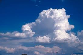
CUMULUS Clouds are the most common clouds, the low-level white clouds look like puffy stacks of cotton balls. These are the clouds in which we can visualize rabbits, faces and alligators and what the imagination can render. They are are detached and individual. If cumulus clouds are present and are are not too tall the weather is typically nice. If conditions allow these can grow in height and size and can eventually form into cumulonimbus clouds which can indicate bad storms are likely. All cumulus clouds develop as a result of convection.
STRATUS Clouds are not puffy or billowing but are typically a gray color at the bottom which indicates water. They look like a continuous layer ( Strato ). They offer a gloomy overcast day and can provide light rain or drizzle, rain or snow.
CUMULONIMBUS low-level clouds grow on hot days when warm, wet air rises very high into the sky. From far away, they look like huge mountains or towers. If you watch and pay attention you can see the clouds change and keep on growing. These clouds can produce violent weather including heavy rain, hail and tornadoes.
High level clouds are Cirrus, Cirrostratus, and Cirrocumulus
High level clouds are far up in the sky, about 4 to 7 miles altitude, where temperatures are below freezing, so they are made of ice crystals.
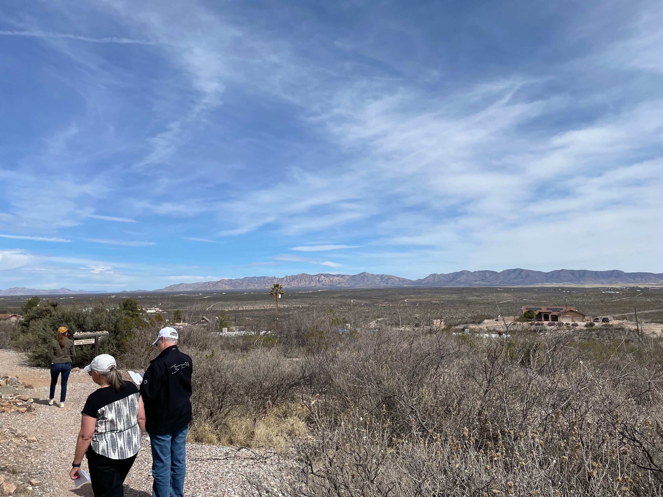
CIRRUS Clouds looks like thin wispy curly locks of hair as shown in the image. Seeing these clouds in the sky usual tells us we will have fairly nice weather for a couple of days. Cirrus clouds indicate a change is coming.
CIRROSTRATUS Clouds are also high level but fill most of the sky and look like very-very thin batting in a blanket. They are commonly found in winter months and are ice crystals. The Sun or Moon above cirrostratus clouds give the appearance of having rings around them, which is caused by the light bouncing between the ice crystals. Cirrostratus clouds might indicate rain and/or snow can occur in the next day, although not very probable.

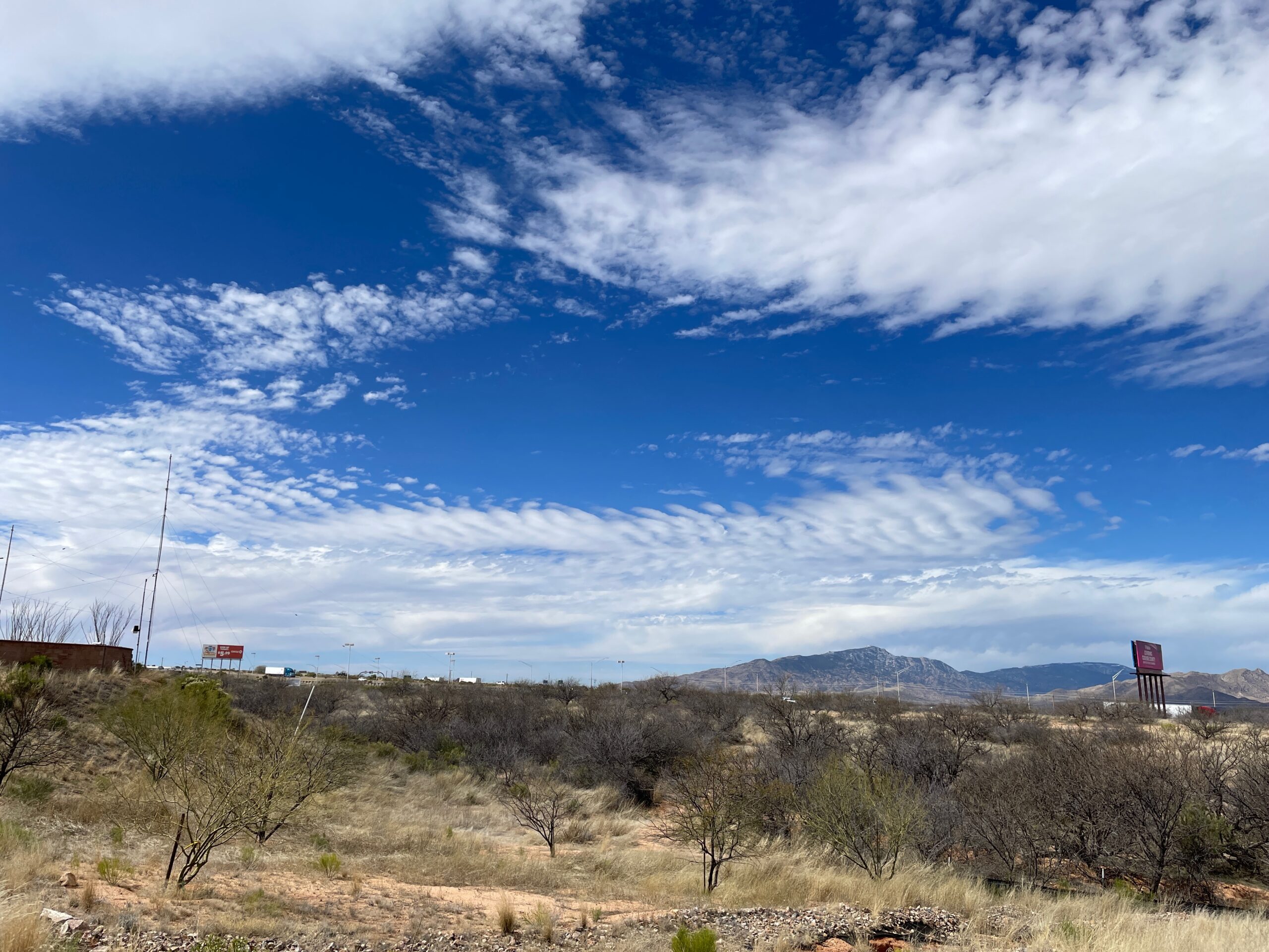
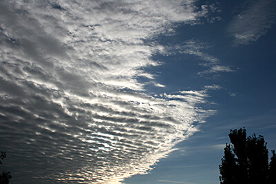
CIRROCUMULUS Clouds, also high level, are layered and have small clumps/lumps, see the image. These clouds can form what look like white color waves in the sky. Sunrise and sunset against cirrocumulus clouds can be quite impressive as the red and yellow light reflects along the bottom. Weather prediction: Fair, but cold.( the clouds are ice )
Mid level clouds are altostratus, altocumulus and Nimbostratus
Alto Mid level clouds are between high level cirrus clouds and low level stratos clouds. The mid level clouds altitude is generally 1.5 miles to 4 miles above the ground. Depending on temperature, altitude and time the clouds may consist of water vapor, ice crystals or both.

ALTOCUMULUS mid-level clouds are gray or alternating with white composed of ice crystals and water droplets. These clouds have a rippled appearance in which air is rising or falling amongst the ripples depending on the localized air temp and water content. Altocumulus clouds usually cover the entire sky. A weather prediction might be fair with these clouds present, although over the span of a day of transformation could lead to rain.
ALTOSTRATUS mid-level clouds are gray or blue-gray clouds composed of ice crystals and water droplets. The clouds usually cover the entire sky. Weather prediction: Be prepared for continuous rain or snow!
NIMBOSTRATUS mid-level clouds are dark gray clouds that appear to dissolve into falling rain or snow. They are so thick that they often blot out the sunlight. Nimbostratus clouds provide gloomy days with rain or snow
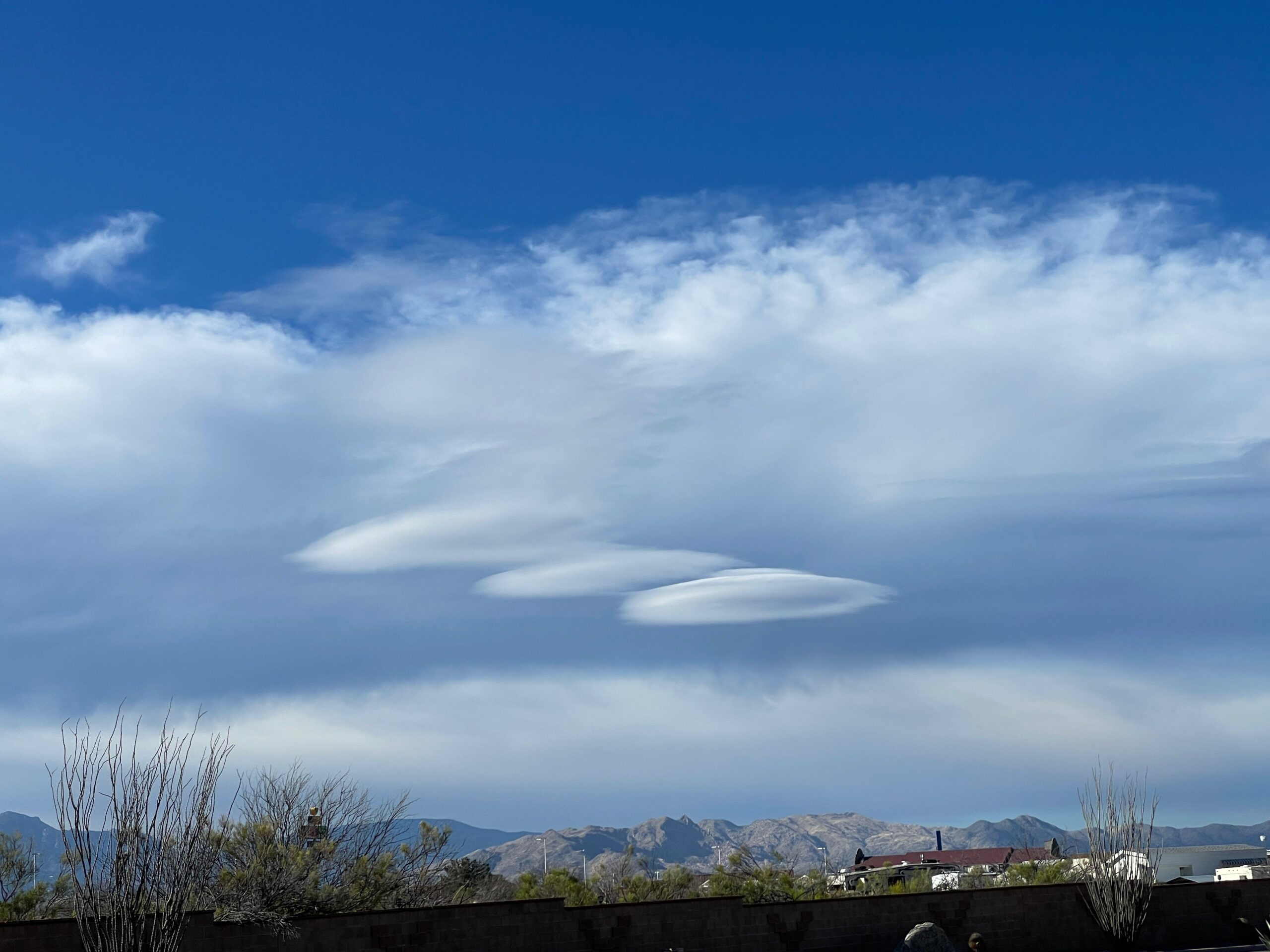
Lenticular clouds are shaped like glass lenses or ufos or Flying Saucers in the Clouds! They may get their shape from hilly terrain or just the way the air is rising over flat terrain. 1
